If you’re a UEP student, you’ve probably spent many a long afternoon with Carolyn Talmadge in the Tisch Library Data Lab. As a 2014 Tufts graduate with an M.S in Environmental Health, Carolyn now works full time as the University’s Senior Geographic Information System (GIS) Specialist. Part of her role is to promote the hard work of Tufts GIS students, which she did recently at the preeminent mapping software company ESRI’s annual conference in San Diego. Read her rundown of highlights and awards below!
I’m back from the ESRI GIS Conference in San Diego where 18,000 people from all industries across the globe gathered to talk GIS for 8 days and I have some really wonderful highlights to share. The whole week was excellent exposure for Tufts and our new GIS Certificate Program and I thought you all would like to hear about it!
Major Highlights:
- I brought 16 of our Students GIS posters to enter into the Map Gallery competition, taking over an entire section. Here is a video if you want to see the set up and all our posters!
- MCM student Gaia Bonini took home 1st place in the Post-Secondary Student Category in the map competition out of 1,400 entries for her poster on “Derailing Conservation: Identifying Suitable Wildlife Crossings across Kenya’s Trans-National Railway”
- MCM student Katherine (Ying) Zhou took home 2nd place in the Post-Secondary Student Category out of 1,400 entries for her poster on “Take the Leopard Home: A Suitability and Connectivity Analysis of North Chinese Leopards”
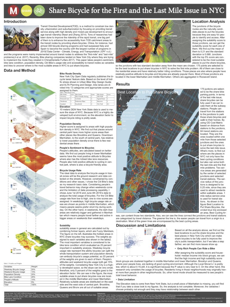
- During the Plenary session in front of 18,000 attendees, ESRI Founder and President Jack Dangermond personally showcased UEP Student Wencong Xu’s final map “The Best Locations to Put Share Bicycles” and talked about how it was one of his favorite examples of transportation planning and a beautiful visualization as well!
- Five of our students had their maps published in ESRI’s Map Book that is given out as gifts to conference attendees and the new “Mapping the Nation” book, including:
- Friedman Student Elisabeth Spratt’s map Swamped: Proposing Wetland Restoration
- Fletcher Student Hojun Song’s map Vulnerability Assessment: Syrian Refugees in Turkey in 2017
- Undergrad Slide Kelly’s map Analyzing Infill Development Suitability in Denver
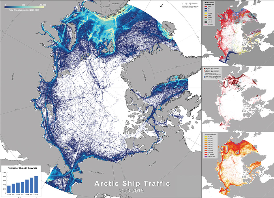
- Fletcher Student Greg Fiske’s map Patterns in Arctic Shipping
- Fletcher Student Usman Mohammed’s map on A Geospatial Analysis of the China-Pakistan Economic Corridor (from Mapping the Nation book and not available online).
- I was interviewed by Diane Sinton and Marybeth Price on our new GIS Certificate Program and participated in the ESRI’s GIS Education Advisory Board Committee discussing best GIS practices in Universities across the USA.
Overall it was an excellent conference with really fantastic exposure for Tufts University and the Data Lab. Lots more exciting news during the 10 days, but these are the highpoints. Definitely worth the trip!

UEP MA ’18 Wencong Xu’s final map “The Best Locations to Put Share Bicycles”
